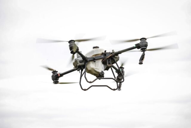
Imagine surveying a vast construction site in minutes instead of days, or mapping an agricultural field with pinpoint accuracy from above. The rise of aerial mapping and surveying drones has transformed how businesses collect data, monitor infrastructure, and secure large areas. These flexible tools have made once-complex tasks more accessible and efficient, changing expectations across multiple industries.
Key advantages of commercial drones in surveying and mapping
For companies responsible for land development, agriculture, or resource management, quick and precise data is essential. Aerial mapping and surveying drones can capture detailed images, generate 3D models, and provide real-time analytics. Their ability to cover extensive terrain, even in challenging environments, gives businesses a significant edge over traditional surveying methods.
Using drones for mapping reduces time on-site and minimizes human error. Drone mapping also delivers high-resolution outputs such as orthomosaic maps and digital elevation models, which support better decision-making in construction planning, crop management, and land assessment. Drone operators can schedule regular flights, ensuring up-to-date records without the need for constant manual labor.
Drones for inspection and utility monitoring
Commercial drones have become indispensable for inspecting assets like power lines, wind turbines, and pipelines. These platforms reach difficult or dangerous locations, capturing images and video without exposing people to risk. Drone utility inspection is now a standard in the energy and infrastructure industries, enabling teams to identify issues like corrosion, vegetation encroachment, or structural damage early on.
- Reduced downtime, since inspections are quicker and less disruptive
- Comprehensive data collection, including thermal imaging for detecting faults
- Lower operational costs by avoiding scaffolding, lifts, or helicopters
Applications extend beyond utilities. Warehouse operators, large-scale manufacturing sites, and transportation hubs use drones to monitor equipment, inventory, and facility conditions, streamlining maintenance schedules and asset management.
Security and surveillance applications
Drones play a growing role in site security. Surveillance drones can patrol perimeters, monitor crowds, and provide live video feeds to security teams. Their rapid deployment and aerial perspective are especially valuable for large properties or events where conventional cameras may leave gaps.
With features like automated flight paths, night vision, and integration with alarm systems, drones can supplement or even replace some fixed security infrastructure. Drone security solutions support incident response, help deter intruders, and provide comprehensive records that aid investigations.
Understanding UAVs and drones: Is there a difference?
The terms “drone” and “UAV” (unmanned aerial vehicle) are often used interchangeably, but there are subtle differences. UAV refers specifically to the flying vehicle itself, operated remotely without a pilot onboard. The word “drone” typically encompasses the entire system, including the UAV, control station, and data link. In commercial settings, most solutions marketed as drones are technically UAVs paired with software and sensors tailored to specific tasks.
Where to find practical guidance on commercial drone deployment
Choosing the right drone platform for your business needs involves assessing factors like payload, flight time, sensor compatibility, and regulatory requirements. For step-by-step advice on evaluating commercial drones for mapping, inspection, or security, refer to detailed buyer’s guides and case studies that break down specifications and use cases across different industries. These resources help you compare options and select technology that fits your operational goals, compliance obligations, and budget.